For the landman handing off a map and any firm that gets shapefiles
Stop emailing a KMZ. Share a live map.
Import the files your firm already works in — shapefiles, GeoJSON, KMZ, even a whole ArcGIS project package — and turn them into a live, clickable map you share with a link. The independent who maps tracts for clients hands over an interactive deliverable instead of a static PDF; the firm that just gets a pile of shapefiles finally has somewhere to view and send them.
- Landman · the hand-off
- Map · Share
- Part of the Landspect suite
What it does
From a folder of shapefiles to a map anyone can open.
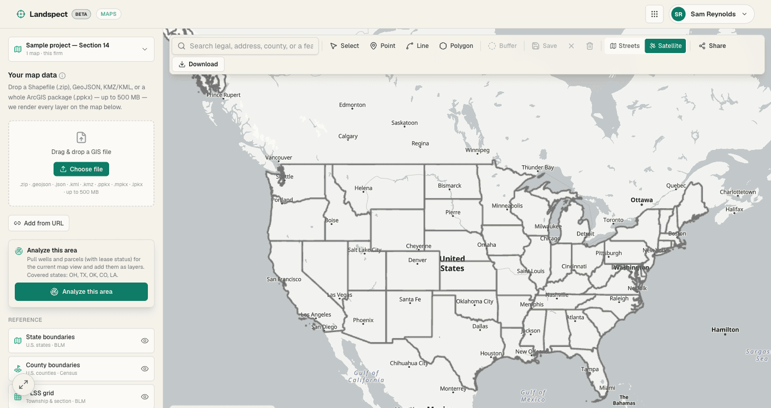
Maps takes the GIS files that land work already runs on and turns them into something a client can actually use. Upload a shapefile, GeoJSON, KMZ, or an entire ArcGIS project package, and Maps renders it as a live, clickable map. Click any parcel to read its leasing, well, and owner data; share the map with a link so clients open it in a browser instead of wrestling with Google Earth; and let the team update tracts together. It is a better deliverable than a static PDF and a better hand-off than emailing a KMZ — and it is live now.
Where it stands
Landspect Maps is live. Upload a shapefile, GeoJSON, KMZ, or a whole ArcGIS package, share the live link, and click any parcel for its data. Maps comes with your Landspect seat — there is no separate per-map fee. Open Maps to bring your files in now.
Import what you already have
Drop in a Shapefile, GeoJSON, or KMZ — or a whole ArcGIS project package — and Maps renders it as a live map. No reformatting, no rebuild.
Click a parcel for the detail
Tap any parcel on the map to see its leasing, well, and owner data inline — the map is the way in, not just a picture.
Share a live link
Send clients a live map link they open in a browser. A real interactive deliverable instead of a static PDF or a KMZ they have to load in Google Earth.
Update tracts together
Collaborative tract updates keep the firm and the field on the same map, so the version everyone sees is the current one.
Export when you need a file
Export back out to KMZ, KML, or DXF when a client or system needs the underlying file — the map stays the working surface, the file is on demand.
On the Landspect architecture
Maps sits on the same connected platform as the rest of the suite, so tracts, parcels, and ownership line up with the work you already do in Landspect.
See it on a real tract.
Everything runs on one connected architecture — try it on your own records.
- Import what you already have
- Click a parcel for the detail
- Share a live link
The rest of the suite
One seat, the whole engagement.
- Beta
Lease Check
Draw an area on the map, see every parcel by lease status, and export a call-ready list.
Explore - Beta
Plotter
Turn a deed's metes-and-bounds or a section/aliquot description into a closed, plotted tract.
Explore - Beta
Title
Walk the chain of title instrument by instrument into the abstract and the MOR deliverable.
Explore - Beta
Clients
The companies that hire you, with the engagement history written by the work you already did.
Explore
Get started
Get started with Landspect Maps.
Create your account and put it to work on real deeds today.