For the landman running a lease check
Draw a box on the map. Get a call list.
The mirror image of title work: instead of abstracting a tract you already have, find the ones worth pursuing. Draw an area of interest and Lease Check surfaces every parcel, its owner, and its lease status — then exports the list you can start dialing.
- Landman · lease checks
- Find
- Part of the Landspect suite
What it does
From an area of interest to a call-ready list.
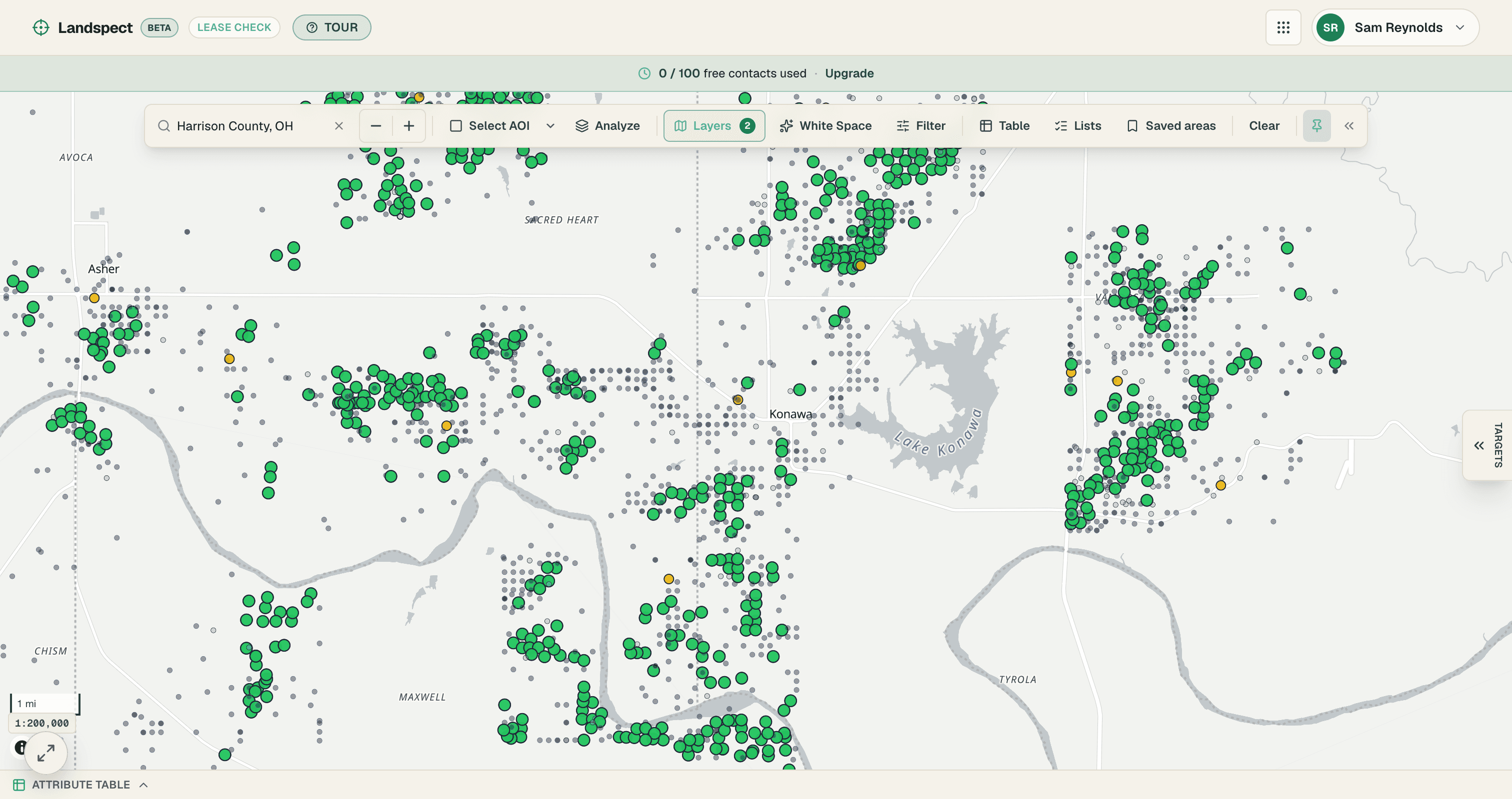
Lease Check lets you draw an AOI on the map and see every parcel inside it, each tagged by lease status — open, expiring soon, or leased and held by production. Filter to the acreage that is actually available, attach owner contact context, and export a prioritized acquisition list ready for outreach.
Where it stands
Lease Check started life as a standalone prototype and is folding into the Landspect platform now — sharing the same map, login, and data architecture. Get on the early-access list to be in the first wave.
Draw an AOI
Draw an area of interest right on the map and Lease Check pulls every parcel inside it — no county-by-county hunting.
Lease status at a glance
Each parcel is tagged open, expiring, or leased / held by production, so you can see where the available acreage actually is.
Expiration tracking
Surface leases coming up for expiration so you can time outreach to the window when acreage frees up.
Owner context
Pair each parcel with its owner of record so the list you build is ready to act on, not just a map.
Export the call list
Push a prioritized, call-ready acquisition list out of the map and into your outreach workflow in one step.
See it on a real tract.
Everything runs on one connected architecture — try it on your own records.
- Draw an AOI
- Lease status at a glance
- Expiration tracking
Coverage
2,050,535 parcels. 2,285,427 wells.
Loaded and queryable across 16 states, built from free public records rather than rented from a data vendor. It is there when you draw an area, not fetched on request.
| State | Parcels | Wells | Leases |
|---|---|---|---|
| OhioOH | 1,245,619 | 242,231 | 120,357 |
| ColoradoCO | 332,552 | 119,001 | 3,650 |
| TexasTX | 247,983 | 63,407 | 37,616 |
| New MexicoNM | 196,781 | 140,834 | 13,533 |
| WyomingWY | 22,227 | 208,653 | 13,220 |
| UtahUT | 5,373 | 40,188 | 3,177 |
| KansasKS | — | 517,519 | 434 |
| OklahomaOK | — | 411,495 | 5,475 |
| PennsylvaniaPA | — | 224,363 | 73 |
| West VirginiaWV | — | 118,614 | 221 |
| North DakotaND | — | 43,774 | 10,416 |
| MontanaMT | — | 42,026 | 3,009 |
| LouisianaLA | — | 37,500 | 1,254 |
| ArkansasAR | — | 33,791 | 413 |
| MississippiMS | — | 25,267 | 165 |
| AlabamaAL | — | 16,764 | 18 |
| Total | 2,050,535 | 2,285,427 | 214,891 |
Counted August 2026. Leases include both leases recorded at the county and state or federal lease tracts. Totals also include federal lease tracts in 9 further states (1,860 leases) that have no wells or parcel fabric yet, so they are counted but not listed. A dash means we do not have that layer in that state: Kansas and Oklahoma have wells but no parcel fabric, Ohio has both. Coverage is expanding; if your county is not here, tell us and it moves up the list.
The rest of the suite
One seat, the whole engagement.
- Beta
Plotter
Turn a deed's metes-and-bounds or a section/aliquot description into a closed, plotted tract.
Explore - Beta
Title
Walk the chain of title instrument by instrument into the abstract and the MOR deliverable.
Explore - Beta
Maps
Turn shapefiles and ArcGIS packages into a live, shareable, clickable map.
Explore - Beta
Clients
The companies that hire you, with the engagement history written by the work you already did.
Explore
Get started
Get started with Landspect Lease Check.
Create your account and put it to work on real deeds today.