Built by landmen, for landmen
Land, inspected.Faster. Cheaper. Defensible.
Plot the deed, run the chain, track the curative, and deliver the abstract, MOR, and a live, shareable map.Everything you need to complete the job, on one platform. $249/seat.
No card to start. Exports unlock when you subscribe.
Hover a module to preview it
One seat · five modules
Every module writes to the same tract.
Plot a deed and the polygon is already on the map. Run the chain and the owners are already in the MOR. Nothing gets re-keyed, because there is nothing to re-key it into.
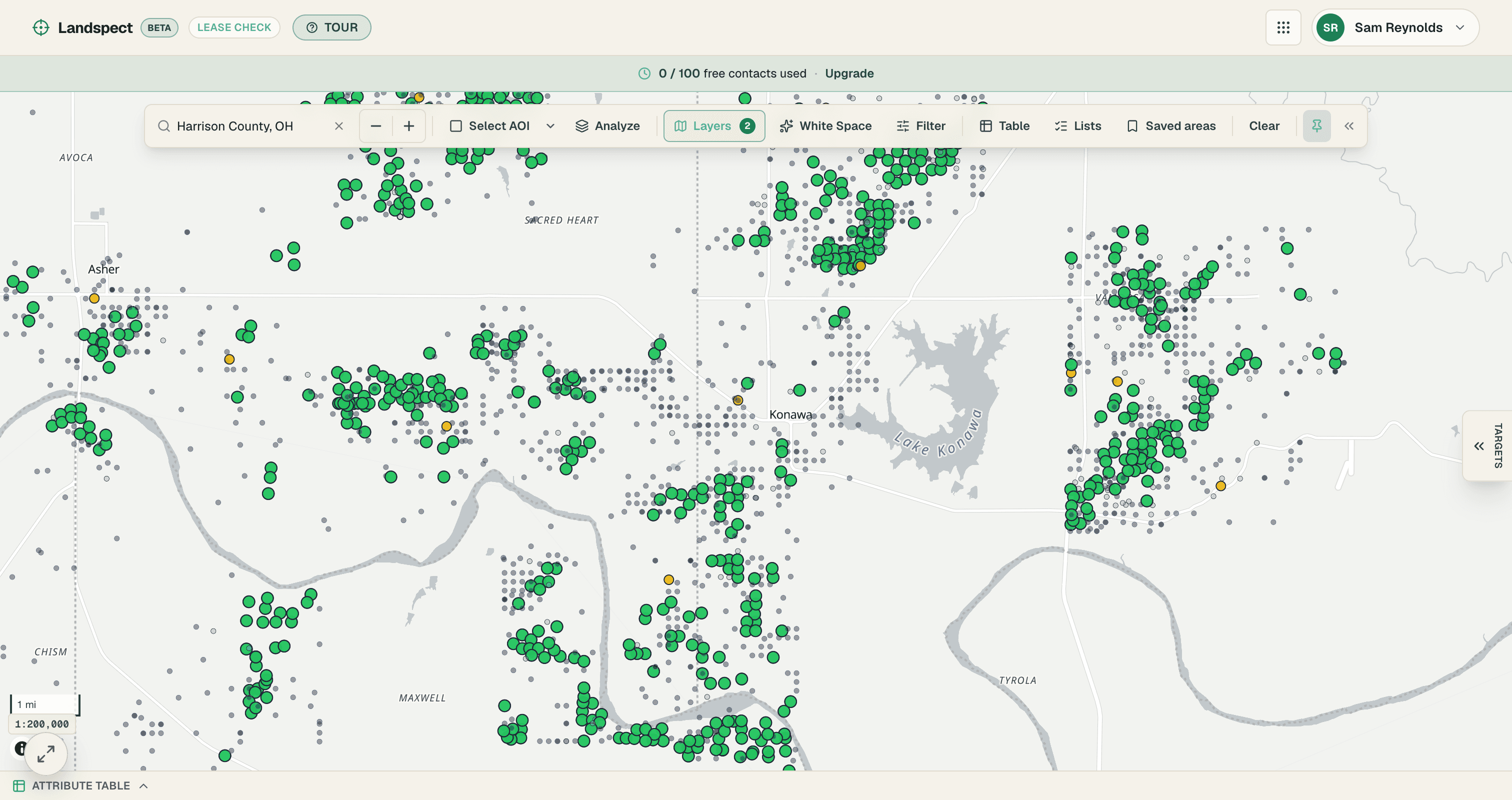
- Is it open?Lease CheckDraw the area and see which parcels are open, who holds them, and when the leases expire.
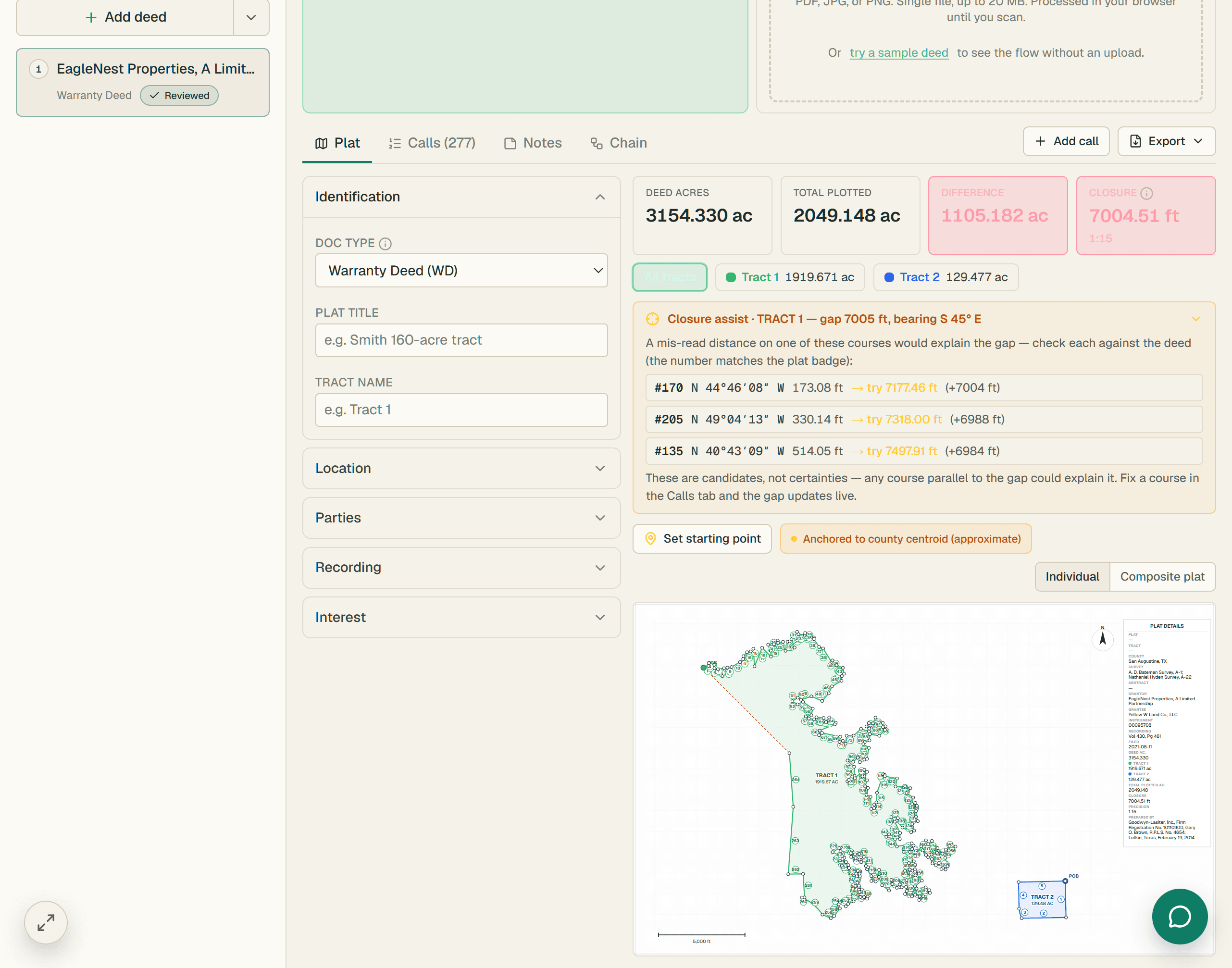
- The geometryPlotterA metes-and-bounds or PLSS description into a closed, measured tract.
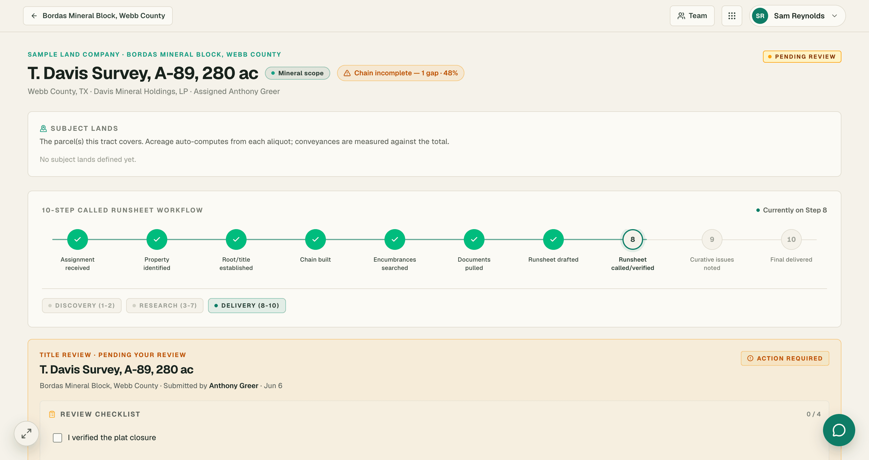
- The deliverableTitleThe chain, instrument by instrument, into the abstract and the Mineral Ownership Report.
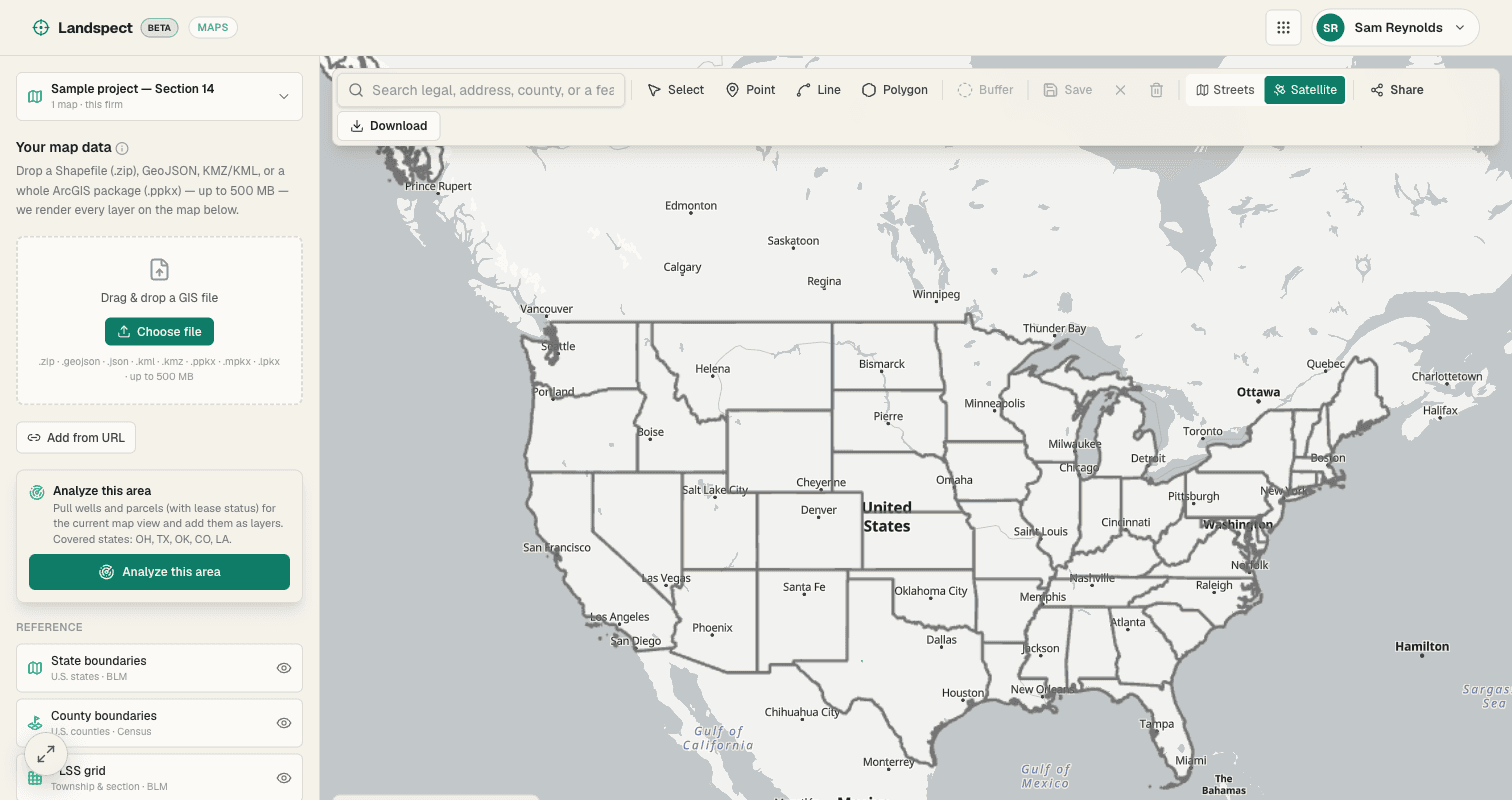
- The hand-offMapsA live map your client opens in a browser, not a static PDF.
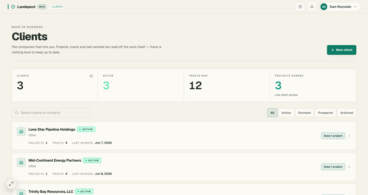
- Your bookClientsThe companies that hire you, and everything you have run for them.
Inside Title
- Plat & ChainWalk the calls, see the closure
- RunsheetThe chain, instrument by instrument
- OwnershipWho owns what, five ways to see it
- Title WorkGaps, exceptions, identities, indexing
- ResearchCounty deep links, capture a finding
- NotesTract notes
Every module reads and writes the same record. The plat, the chain, the owners, the curative requirements and the recorded documents are one object — so the work is never entered twice and never disagrees with itself.
Why Landspect
Already built. Already loaded.
Most of what a landman is pitched is a roadmap. This runs today, on real records, with the data already in it.
Live today, not a waitlist
All five modules run in production against real tracts. Sign up and take a tract from lease check to a delivered map in the same afternoon. Seven-day trial, no card.
1.6M+ parcels already loaded
820,000+ wells and 150,000+ recorded leases behind the map, built from free public records rather than rented from a data vendor. It is there when you draw an area, not queued.
Built by a working landman
Shaped by a registered professional landman who runs this work, not guessed at by software people who arrived in energy late. The judgment calls are made the way the job actually makes them.
One seat, one price
Every module comes with the seat. Nothing to bolt on, no per-map fee, and the API a firm connects to is free.
What it costs you
Pays for itself in about 15 minutes a day.
You bill by the day, so price the seat that way. At a $400 day rate, Landspect costs about 5.0 hours of your time a month — $12 a working day, or 3.1% of what you bill.
$50 an hour over an 8-hour day
5.0 hours over 20 working days
Time recovered, in money
$250/ month
Less the $249 seat
+$1
Assumes an 8-hour day and 20 working days a month, against the $249 seat. Actual savings vary by workflow and how much of the job you run in one place.
Pricing
One seat. Every module.
One thing to buy, one price to know. Everything below comes with it.
Or $2,499/yr prepaid — two months free.
No card to start.
Start free trialExports unlock when you subscribe.
Included in every seat
- Lease CheckDraw an area on the map, see every parcel by lease status, and export a call-ready list.
- PlotterTurn a deed's metes-and-bounds or a section/aliquot description into a closed, plotted tract.
- TitleWalk the chain of title instrument by instrument into the abstract and the MOR deliverable.
- MapsTurn shapefiles and ArcGIS packages into a live, shareable, clickable map.
- ClientsThe companies that hire you, with the engagement history written by the work you already did.
- Every export: runsheet, abstract, MOR, plat, KML, DXF, GeoJSON, PDF
- One connected record — nothing re-keyed between modules
- New modules included as they ship
About
Built by a landman, for landmen.
Landspect is built by people who actually run the deeds. Twenty-two years of land plus GIS expertise paired with software that ships — every product shaped by the way the work is really done, not guessed at from the outside.
I have run title by hand for two decades. Landspect does in thirty seconds what used to take me an hour, the fractions stay honest, and the chain visualization catches things a spreadsheet never would.
Louis Baggett, RPL
Co-Founder · 22 years O&G land + GIS
FAQ
Before you ask what it costs.
What the platform is, what a seat carries, and who can see your work. Pricing questions are answered on the pricing page.
Do you cover my county?
Wells are loaded across sixteen states and leases across twenty-five, and what you get differs by state and by data type. Kansas, for one, has 517,519 wells and no parcel fabric; Ohio has 1.25 million parcels and 242,231 wells. The state-by-state table gives you the counted numbers before you subscribe, not after.
Do I need to be a landman already, or hold a licence?
No. Signing up asks for an email address and a password — there is no licence number, association membership or degree anywhere in the form. The tools do assume you can read a deed: Plotter takes metes-and-bounds calls, and Title walks a chain instrument by instrument.
What do I actually get for one seat?
Five modules: Lease Check to find the open acreage, Plotter to plot the deed, Title to run the chain into the abstract and the Mineral Ownership Report, Maps to hand the client something live, and Clients to hold the book of business those engagements build up. There is nothing to turn on separately — the seat carries all five.
Can my client see my work in progress?
Only what you explicitly share, one project at a time. Filing a project under a client is bookkeeping and grants nothing; a live share is the entire grant, and neither the CRM link nor an API key nor a subscription substitutes for one. Revoking is one click, and the revoked share stays in the history so you can see what was open and when.
Is my work private from other landmen and other firms?
Yes. Projects, tracts, maps and prospect lists are behind row-level security keyed to your firm, so someone outside it has no read path to them at all. Inside your firm you can mark a project confidential, which narrows it again to the people named on it.
Can my firm pull the finished work into its own system?
That is what the API is for, and it costs the firm nothing — the landman buys the seat. Five read-only endpoints return the tract, the runsheet, computed ownership and the plat as GeoJSON, with keys scoped so a firm key sees only that firm and a client key sees only the projects shared with it. Read the API page.
Where does the data come from?
Public records. State oil and gas regulators — the Texas Railroad Commission, Colorado ECMC, Oklahoma Corporation Commission, New Mexico OCD and Louisiana SONRIS — plus BLM federal lease records, county assessor parcel GIS and county recorder indexes. Every source is catalogued with its provider, its official URL and the terms it comes under.
Get started
Get started with Landspect.
Create your account and start plotting deeds today — your first three are on us.
Data security
Your land data stays yours.
Ownership, lease, and title records are sensitive. Landspect is built so your data stays isolated, private, and protected — by default and at the data layer, not as an afterthought.
Your firm's data is walled off
Row-level security isolates every firm in the database. Another company on Landspect cannot see, query, or touch your tracts, deeds, or maps — the boundary is enforced at the data layer, not just the UI.
One login, one person
Single active session per account. A login can't be quietly shared across a team — signing in on a new device signs the old one out. Your seats are your seats.
Two-factor authentication
Turn on authenticator-app (TOTP) 2FA on your account, with SMS verification as well. A stolen password isn't enough to get in.
Encrypted in transit and at rest
Everything moves over TLS, and your data is encrypted at rest on managed Postgres. Nothing sensitive travels or sits in the clear.
Private by default
Your maps and records are private until you decide to share. Every share link is yours to control — public, password-protected, or set to expire — and revocable any time.
Built on trusted infrastructure
Landspect runs on SOC 2-compliant infrastructure (Supabase and Vercel). We don't sell your data, and your records are never the product.