For the field landman
A deed in. A plotted tract out.
Stop hand-keying metes-and-bounds into a CAD seat. Paste the description or upload the deed, and Plotter walks the calls, closes the polygon, and reports the acreage — in seconds, not an afternoon.
- Landman
- Plot
- Part of the Landspect suite
What it does
From legal description to a closed tract.
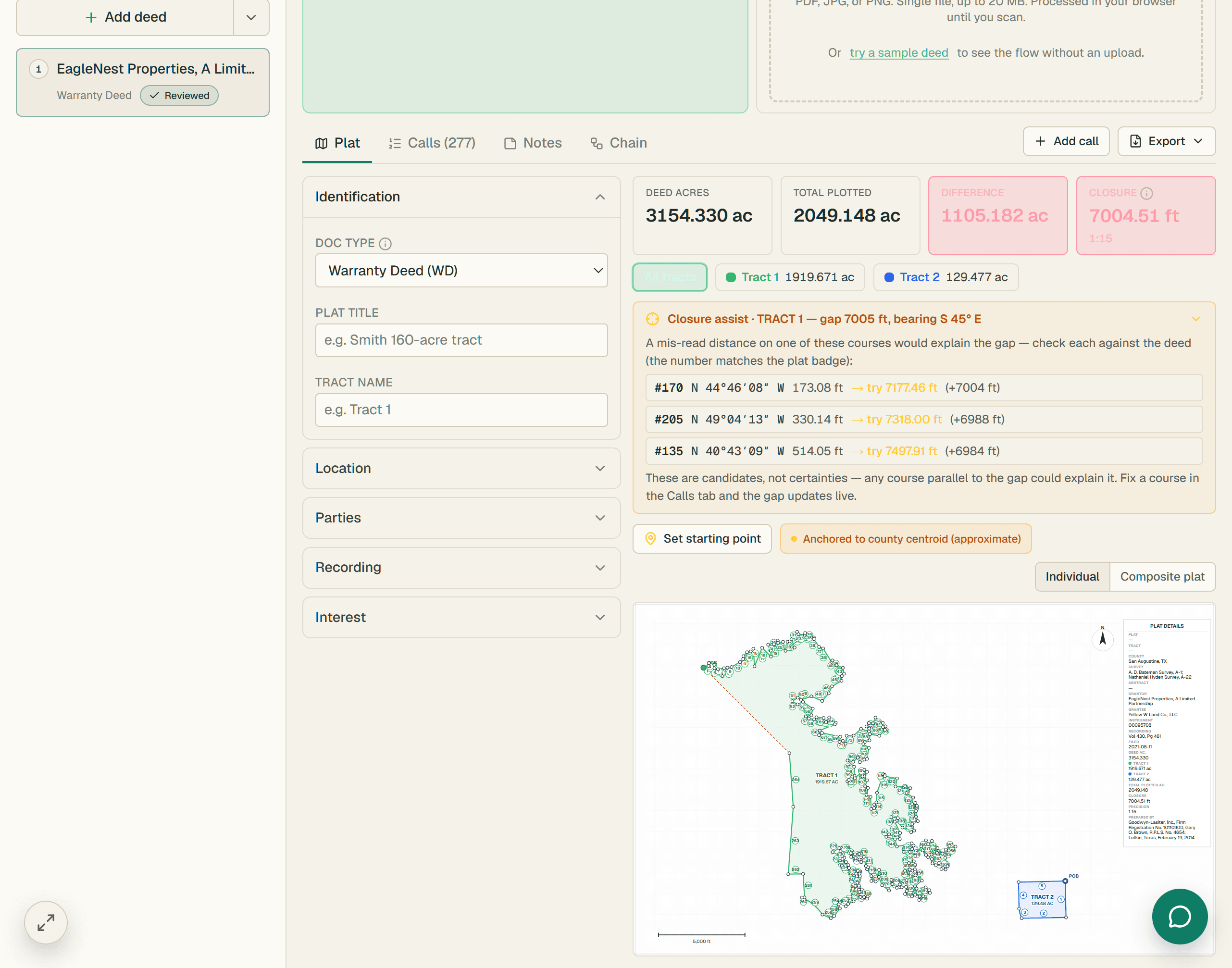
Plotter reads a deed's metes-and-bounds or a PLSS section/aliquot description, classifies each call, walks the perimeter, and returns a closed polygon with closure error and computed acreage. The landman reviews and corrects — the polygon only walks what belongs.
Metes & bounds
Paste or read a description and Plotter parses each bearing-and-distance call into a closed traverse with closure error to the hundredth of a foot.
Section & aliquot
PLSS descriptions — NE/4, S/2 of the SW/4 — resolve to the right aliquot inside the section grid, no manual quartering.
Deed scan
Upload an OCR-readable deed and Plotter extracts the calls, the call types, and the recording references for you to confirm.
Closure & acreage
Perimeter, closure, and acreage computed automatically, with per-call confidence so you know exactly what to double-check.
Export anywhere
One click to a legal-size plat PDF, DXF for CAD, KML for Google Earth, or GeoJSON for the GIS team.
See it on a real tract.
Everything runs on one connected architecture — try it on your own records.
- Metes & bounds
- Section & aliquot
- Deed scan
Document intelligence
The calls, the closure, the reservation language.
Upload an OCR-readable deed and Landspect extracts key title data, walks the calls, plots the tract, runs closure calculations, and captures the information landmen need for title review: grantor, grantee, recording references, acreage, mineral interests, and reservation language.
Full deed metadata
Volume and page, instrument number, effective date, signing date, recording date, acreage, mineral interest conveyed.
Call-type aware
Perimeter, tie, bearing tree, and adjoiner calls classified separately. The polygon walks only what belongs.
Reservation detection
Reservation language is extracted and highlighted so landmen can quickly evaluate its impact on ownership.
| L | Type | Bearing | Dist | Conf |
|---|---|---|---|---|
| 1 | PERIMETER | S 83°47' E | 738.25' | 98 |
| 2 | PERIMETER | S 8°53'10" E | 362.31' | 97 |
| 3 | PERIMETER | N 83°39' W | 736.34' | 96 |
| 4 | PERIMETER | N 9°15'09" W | 361.17' | 97 |
| 5 | TIE | S 9°15'09" E | 636.51' | 92 |
| 6 | B.TREE | S 71°30' E | 14.2' | 84 |
PERIMETER
2,198.07 ft
CLOSURE
0.43 ft
ACRES
5.901
The problem
Title work hasn't changed much in thirty years.
The expertise hasn't changed. The workload has. Landmen evaluate more records, more tracts, and more ownership interests than ever — using largely the same tools.
Hours, days, even weeks per tract
Some tracts don't take long. But depending on the difficulty, a single tract can run days — even weeks.
Ownership errors compound quickly
A single mistake in the interest math can flow through every owner report, division order, and title opinion that follows — disaster by the end.
Reservations slip through
Mineral reservations, NPRIs, and exceptions can hide deep in decades of records, creating costly title issues later.
Three tools, three handoffs
Runsheets in Excel. Plats in CAD. Ownership reports in Word. Every handoff is another chance for delay or error.
The rest of the suite
One seat, the whole engagement.
- Beta
Lease Check
Draw an area on the map, see every parcel by lease status, and export a call-ready list.
Explore - Beta
Title
Walk the chain of title instrument by instrument into the abstract and the MOR deliverable.
Explore - Beta
Maps
Turn shapefiles and ArcGIS packages into a live, shareable, clickable map.
Explore - Beta
Clients
The companies that hire you, with the engagement history written by the work you already did.
Explore
Get started
Get started with Landspect Plotter.
Create your account and put it to work on real deeds today.